Details:
Friday, 27th October to Sunday, 29th October 2023
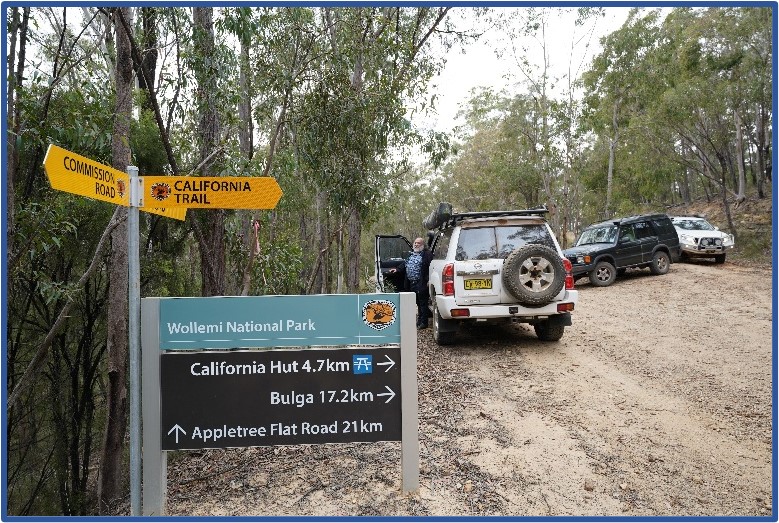
TRAX trip – Kanangra, Kowmung and Yerranderie
G’day,
The Caves to Caves trip is now Kanangra, Kowmung and Yerranderie
TL Rob Drummond – This trip is replacing the Jenolan to Wombeyan trip as Wombeyan is currently closed due to redevelopment.
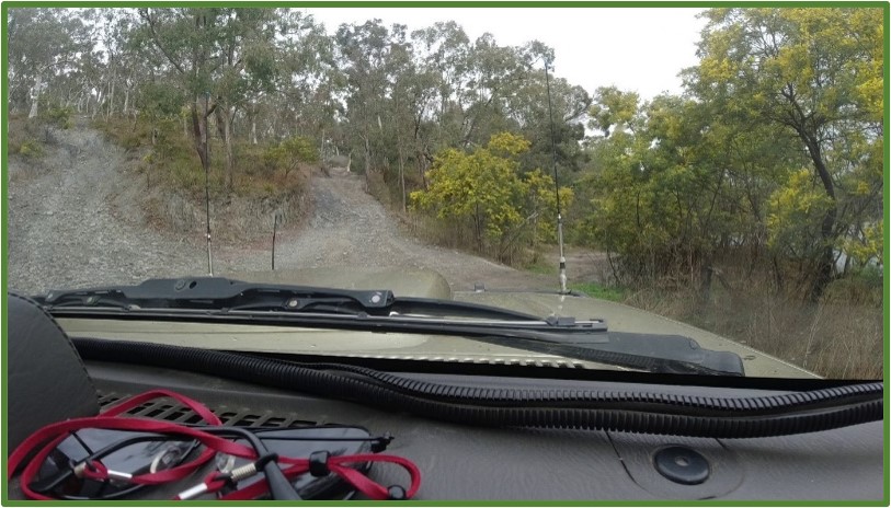
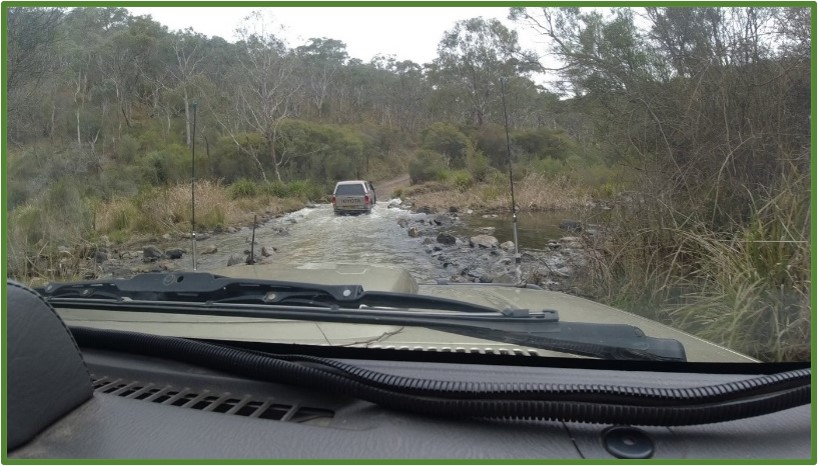
This 4WD trip has creek and river crossings. This will be a slow weekend but covering some spectacular scenery. Meet at Boyd River Campground on Saturday 28th at 09:30am ready to head off at 09:45am. Bring cameras and a full tank of fuel and don’t rely on having a campfire on Saturday night for warmth or cooking.
Camping on Saturday will be at Yerranderie Government Town campground. Hop online and book your own 1 night’s accommodation.
Please note that Jenolan Caves Road remains closed so you will need to travel via Duckmaloi and Edith to Boyd River.
Details:
Monday, 23rd October to Saturday, 28th October 2023
TRAX trip – Albury and surrounding districts
G’day,
A lazy tour especially for Seniors (or anyone!)
ALBURY AND SURROUNDING DISTRICTS
AROUND 5-6 DAYS AWAY FROM SYDNEY
October 23 – 28
* Travel by rail from Sydney using your free Pensioner Pass or
* $7:50 each way using your OPAL card (If a pensioner,) or
* Drive yourself in your own vehicle.
* Good budget accommodation available in Albury, Hire a vehicle (share costs with others to make it cheaper!)
* Great sights/activities in/near the city to make an enjoyable stay.
Just some of the things to do and visits to make!
* Albury Botanic Garden – highly recommended.
* Visit Glenrowan town less than 1 hour south of town. Ned Kelly museum, artifacts, historical scenes.
* Beechworth town – historic Gaol, and other buildings.
* Bandiana – Army Museum – large displays.
* Murray River cruises
* Take a drive up into the ‘High Country’.
* Visit the spectacular Lake Hume and go kayaking on it if you wish.
* And…. some special events in October will feature…
* Albury Wodonga International Horse Trials – one of the ‘must do’ events on the Eventing calendar, with over 400 entries across all levels.
* Albury Wodonga Yacht Club Sail Country – See all the action at Australia’s best inland sailing venue.
* Senior Celebrations – Events and activities that coincide with the Victorian Seniors Festival.
* Albury Flower and Garden Show – Immerse yourself in gorgeous gardens and flower displays this springtime.
* Twilight Markets – Third Thursday in Oct.
And as well:
* ‘History on high Time’-travel back to the heritage-rich town of Beechworth. Only a 45-minute drive from Albury-Wodonga, the timeless beauty of this town is sure to captivate.
Shop for locally produced honey and beauty products at Beechworth Honey or take a sweet cooking class. Visit the
notorious Beechworth Gaol – the one-time ‘home’ of legendary outlaw Ned Kelly, as well as his mother, Ellen.
* From Beechworth, head to Yackandandah for your art and culture fix. Home to a number of renowned artists, ‘Yack’ is known for its artisanal creations, from pottery to fine art including the gallery of celebrated painter Charles Sluga, Sluga Gallery. Enjoy award-winning pies from Gum Tree Pies, a sustainable and seasonal menu at Saint Monday or the Rusty Bike Cafe, then make space in the boot of the car for some antique shopping in the unhurried and historic town of Chiltern.
Wait, there’s more, much more…
If you’re after some fun in the winter snow or a refreshing October highland breeze, Falls Creek, Mt Hotham and Mt Buffalo are all an easy drive from Albury-Wodonga and often still
have snow in October.
FINALLY – the steak knives… Lots of ‘Op’ and 2nd hand shops in the city.
If you come, you will not be organised – you can do what you want on the days that you want, or, you can travel with others in a convoy/group. As TRAX members we will try to meet each night at a local club or eatery to share experiences and discuss the next day’s trips. ‘Sup to you!
Details:
Friday, 13th October to Sunday, 15th October 2023
TRAX trip – Chichester SF Camping Trip
G’day,
Chichester State Forest is divided into two distinct areas, the western side centred on the Allyn River and the eastern side centred on the Telegherry River.
TL Rob Drummond – A cruisy weekend trip visiting the foothills south of Barrington Tops NP around the Telegherry River and Chichester Dam. Meet at Stratford Rest Area, Wood Street, Stratford at 09:00am on Saturday 14th ready to head off at 09:15am. You’ll need a full tank of fuel as some tracks may be gated and we may need to back-track. Bring your camera for pics and your camp oven for a cook up on Saturday night (if fires permitted). On Sunday we’ll work our way to Chichester Dam before heading home via Dungog. Bring your walking shoes too as we’ll try and find a couple of waterfalls.
Time to Stratford 2.5hrs
Time home from Chichester Dam 2.5hrs, both referenced to southern end of M1.
This is a weekend camping trip.
Please note end of registrations for this trip 5:00pm Friday 6thOctober
Trip Leader – Robert Drummond
Email – trips@trax.org.au
The usual stipulations: Camping gear, food, recovery gear, UHF CB channel 13 and camera ( pictures for Editor)
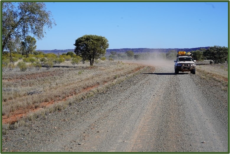
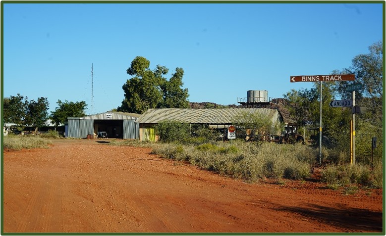
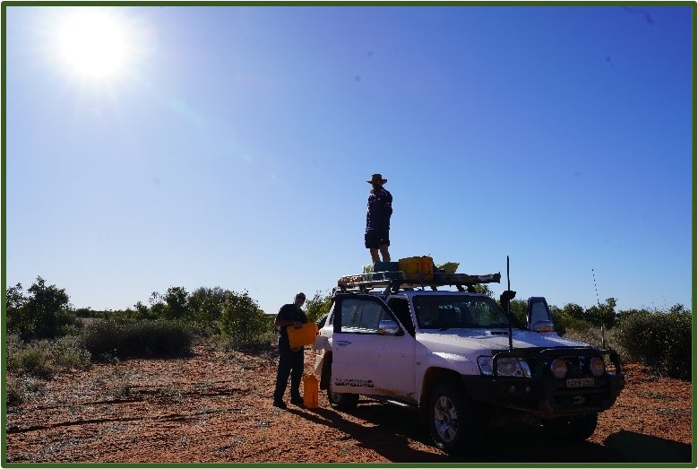
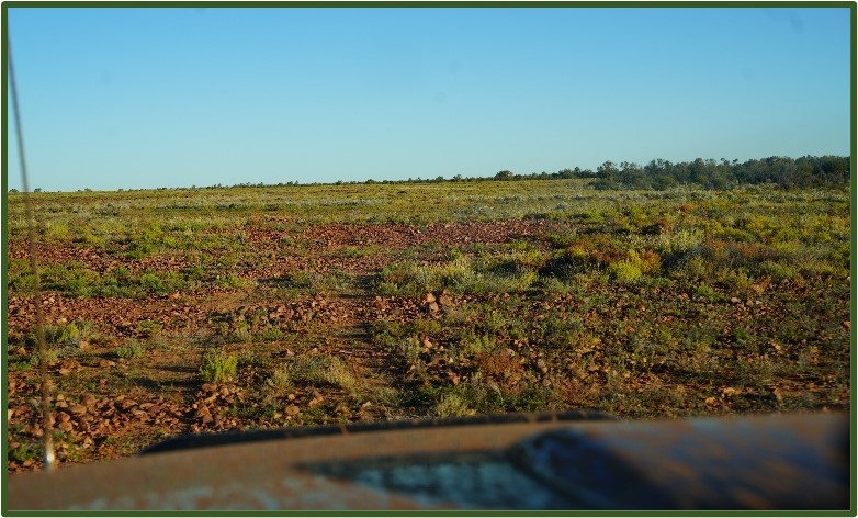
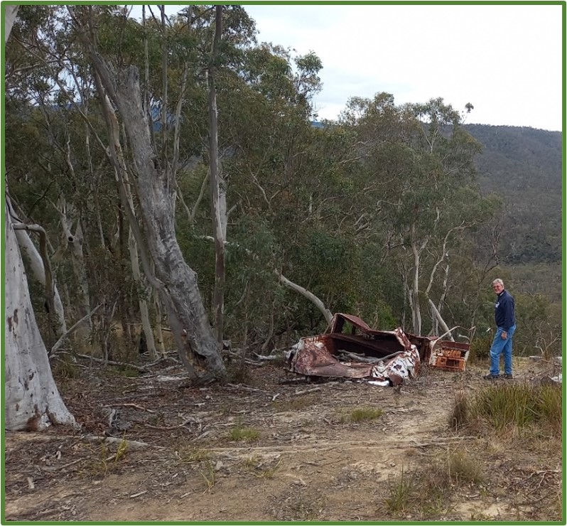
Continued… We reached Alice just in time for elevenses and worked out our plan of attack. The interwebby thing showed access to Birdsville was still blocked but getting to Mt Dare was open with caution via Binns Track or Finke. This left us with a decision to still ‘do the Madigan’ but we needed access to Birdsville to do that, so that wasn’t possible at that time, but would it be possible within 6 days should we set off? The other option would be to get to Mt Dare and then wait for the way through to Birdsville to be open. We were still hopeful we might be able to follow Plan A, do the Madigan, but we would need to check the interwebby thing via our family via satphone as we travelled south to Mt Dare. The decision made was to do the Binns Track, get to Mt Dare and then determine which way we could travel. After stocking up on food, water and fuel, we headed south along the Old Andado Track, which forms part of the much longer Binns Track. The track is wide and well maintained as it’s the only route between Alice and the Santa Teresa township. We continued along with the scenery becoming more interesting the further south we travelled, as we passed between parallel mountain ranges with exposed rock faces. We had to slow down as the track takes you through Allambi Station and even takes a 90 degree bend at the homestead.
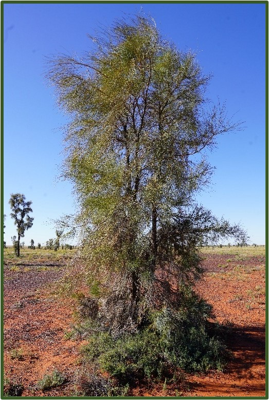
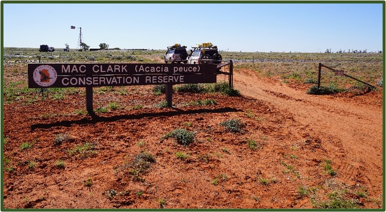
The sun was getting lower so we started looking for a campsite for the night eventually settling on an open space about a kilometre along a not often used track, to the south of the Old Andado Track. We could have stopped earlier than we did, but there was a lot of tall grass coverage after the recent rains. We soon had our camp set up and a fire ready to keep us warm in the cold desert night. Next morning, we packed up and set off towards the Mac Clark Conservation Reserve to see the stand of fabled Acacia peuce. We found the track in good condition and we were able to maintain a reasonable pace – not that we were in any hurry! The track south followed between the parallel mountains (hills really) and dunes, stopping at regular intervals to take photos of the countryside. By mid afternoon we reached the Reserve, navigated the various fences and gates to find the visitor area, then spent a while investigating these very rare trees.
Acacia peuce is commonly known as the Waddy Wood and is a tree that grows to 18 m tall. It has a growth habit similar to a Casuarina. Young trees look like conifers in shape. The dull green phyllodes (pine-needles) are long and thin with a sharp tip, growing 8 cm to 40 cm long and about 1 mm wide. Pale-yellow flowers are produced in autumn and spring usually after heavy rain. The flower heads are globular. The seed pods are oblong and flat with a papery texture, growing to about 20 cm long and 3 cm to 5 cm wide. They are very slow growing and are only found in small pockets within arid zones of Australia.
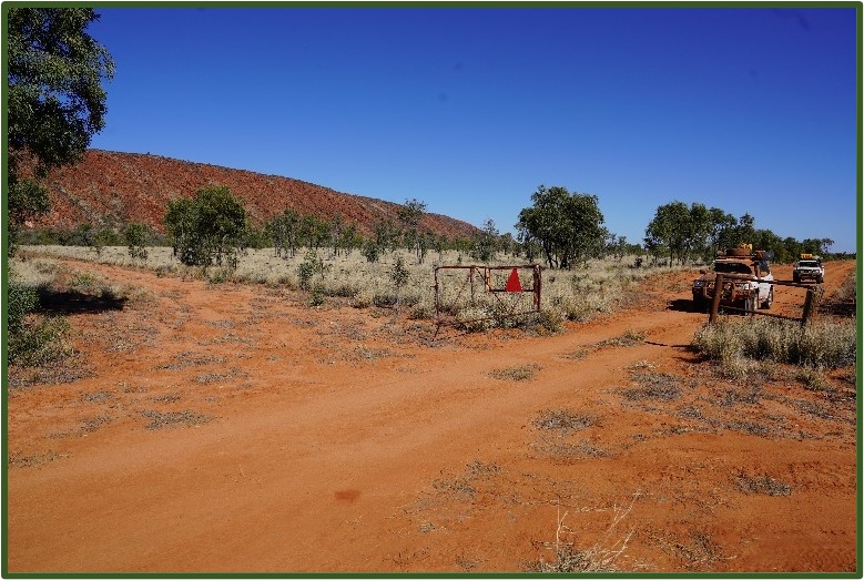
We had already decided to spend a night on the Madigan, just so we could say we had at least been there, so set off retracing our steps to find our way onto the Madigan. So why mention this? Well, in the last few days we had seen a YouTube video of someone trying to find their way from the Reserve onto the Madigan. They couldn’t find any obvious track forward so they apparently followed someone else’s tracks over, yes over (or through) the fence line surrounding the Reserve. Granted, there aren’t any obvious signposts, but I’ve never known the way forward over a wire fence! The way onwards was easy enough to spot even though it was a hand painted sign to the right of the Reserve entrance gate. Following the sign, we navigated wash outs and small lakes to the main track.
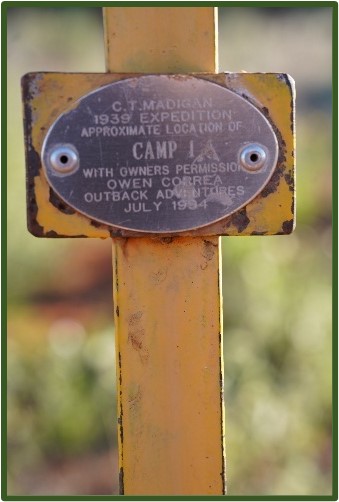
Enroute to our destination of Camp 1A, we found that recent rains had re-aligned the track resulting in the inevitable maze of new tracks as people try to find their way forward. This was particularly true around East Bore, where we spent about 45 minutes ‘exploring’ the area around the track. We found our way onwards enduring the corrugations for the remainder of the trip until we reached Camp 1A. Tonight’s dinner was going to be a bit special, so Alec spent some time ferreting around for firewood then preparing a fire suitable for cooking a lamb roast! Rob spent some time walking around cleaning up after the grubs that ‘love the great outdoors’! After a hearty dinner, we sat around the bush TV and solved the World’s problems…
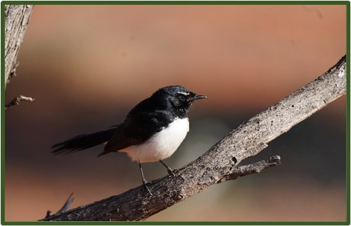
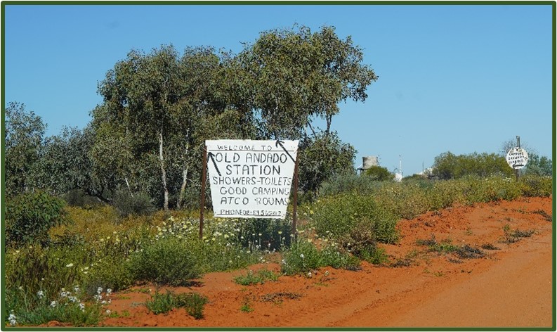
Next morning was crisp and clear and we enjoyed our breakfast with a friendly willee wagtail who tried to evade the cameras which came out to capture this wild bird that was comfortable being so close to the humans invading his territory. Packing up was getting pretty easy at this stage as we were well practiced by now, but the quicker we packed up, the quicker we’d be facing the 30 or so kilometres of corrugations back to the Reserve. Before starting the corrugations, we emptied the diesel jerrys into our tanks reducing the weight on our rooves. We got through the maze around East Bore until we followed a definite set of tracks which quickly ran out, leaving us well away from where we should be. We turned around and backtracked until we saw the remnants of the bore thereby finding the route towards Mt Dare. Passing by the acacia peuce reserve, we quickly found our way on the track towards Old Andado Homestead.
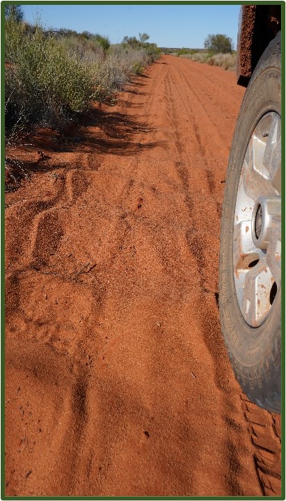
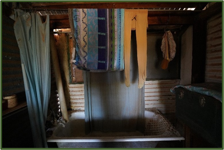
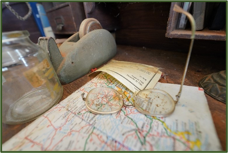
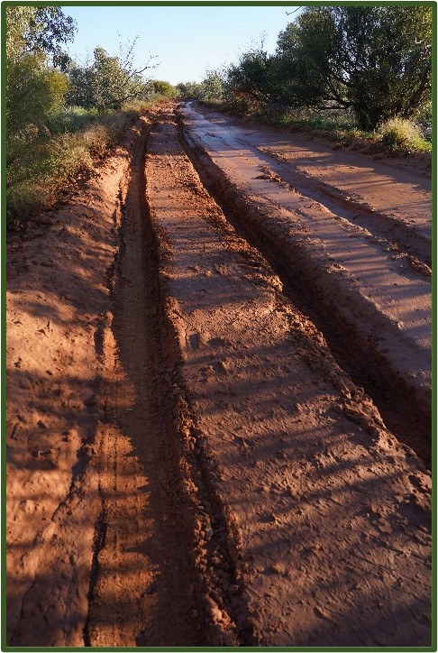
Reaching there around lunchtime, we had a quick snack and explored the buildings and grounds of the abandoned homestead. It is indeed truly remarkable to see how the Clarks lived for so many years in what must be some of the harshest conditions Australia has to offer. The buildings are all open and you’re free, for a gold coin donation, to roam at will. Yes, as you’ve seen on YouTube and read about, everything is still in its final resting place, be that in the bedrooms, the kitchen, the utility rooms etc, with only dust and a few birds interfering with the ‘lived-in’ appearance. We now had about 100kms to get to Mt Dare. The track again, was in good order and we were sitting on 80pkh or so, only slowing down for closed gates or water across the main track. We passed through what we thought should be the NT/SA border with the surrounding countryside showing clear signs of recent water activity. Not long after entering SA, we came across a muddy section of track which appeared to go on for a very long distance – we couldn’t see the end! Rob had the job of scouting the track and wasn’t able to walk without either slipping over in the slippery slush, or sinking over boot height into the slush.
This was frustrating as we were only about 4kms from Mt Dare! It looked as though a large vehicle had been through and left very deep ruts. In parts, the track either side of the ruts was reasonably solid, but the risk of slipping into the ruts and being hung up on the pumpkins was too great a risk. As time was getting on, and not wanting to start on a long after-dark recovery, we tried to get around the bog by venturing out onto the rocky plain to the south of the track. We made slow and bumpy progress, but we weren’t able to get any closer to Mt Dare.
After nearly an hour, we stopped and checked our position on our GPS devices and paper map before deciding that discretion is the better part of val0ur, and hopped on the phone to Mt Dare. We found them very helpful and learnt that someone had indeed driven north from Mt Dare and chewed up the track for about 3 kms! They said we could give it a go and if not successful, they would be happy to come and get us – read “rescue you for a fee if you get stuck”. Not being on a tight schedule, we decided to head back north and camp over the NT/SA border where a camp fire would be allowed. (the area north of Mt Dare to the border is National Park where all fires are banned). We found a large flat space just after crossing the border and set camp had a hearty dinner and watched the bush TV until bed time.
(to be continued) Rob Drummond
Posted inTrip Reports|Comments Off on The Madigan Line Part 2
Trip Report – Marrangaroo Campground and Rydal 4WD area 12 to 13th of August 2023
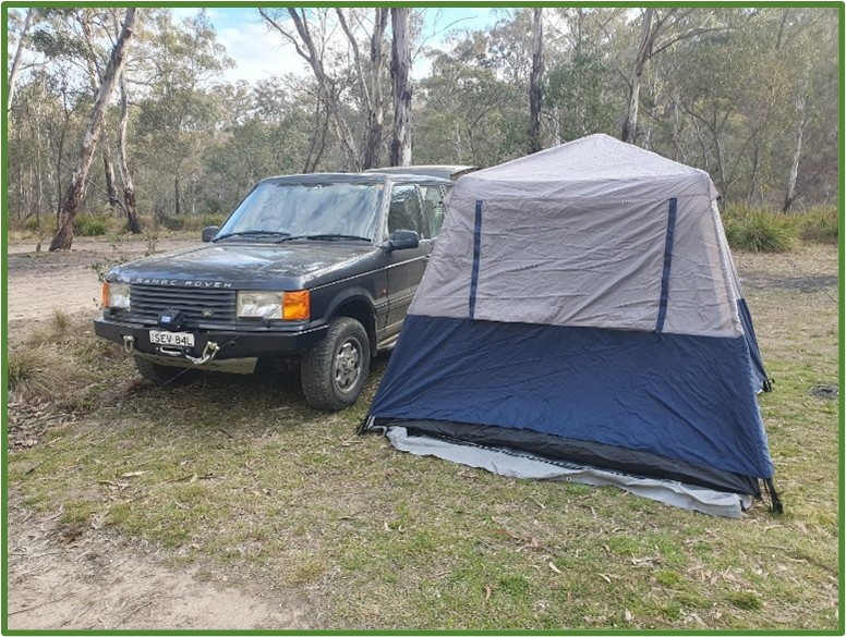
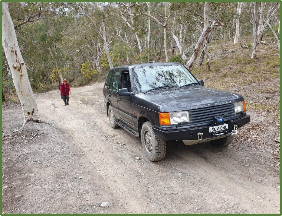
Vehicle & Position, Driver / Passenger Patrol – 1 Daniel Lee /None (TL) Hilux – 2 Peter Frick /None Defender- 3 Jane Parfitt /Sally Parfitt Range Rover – 4 Ralph Radovan /None (TEC)
Start time: 11:00 am at Richmond McDonalds Finish time: 4:00 pm at Lidsdale Forest 20 km west of Lithgow on GWH
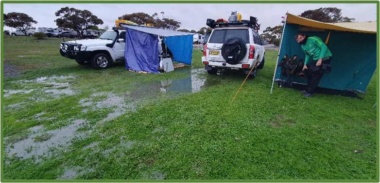
Weather: Fine and sunny on Saturday, minor rain on Sunday morning enough to wet up the tops of the tracks more than just keep the dust down. Some tracks were a little slippery when steep – luckily the recent maintenance grading and new gravel base was welcome. Rain of the way home 5:30 pm from Lithgow!
Report by: Daniel Lee
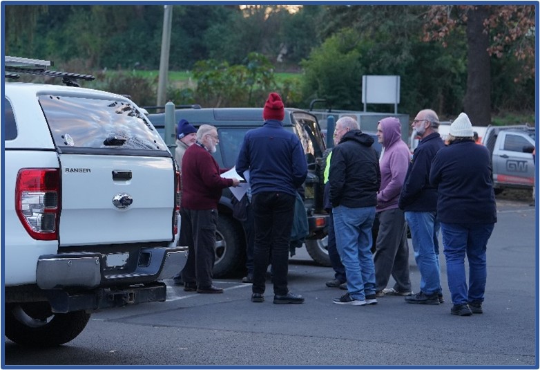
I haven’t led a four-wheel-drive trip – ever! So, after being a member of TRAX for 4 years it was time to strut my stuff!
The trip briefing invite was as follows:
“Meet at McDonalds Richmond Cnr March & East Market Streets, at 10 am to have morning tea. Depart 11 am to drive Bells Line of Road stopping at Mount Tomah Walls Lookout around 11:45 to 12:00 enroute to see the sharp valleys then head to Lithgow arriving around 12:30 pm. Collect any supplies needed in Lithgow and head off to find our camp site.
Set up camp early in the afternoon before it gets cold, relax and plan the following days activities – as I do not know the area and/or each person’s/vehicle’s capabilities or aspirations in terms of being adventurous. It is a get to know you week end! Sunday is a day of exploring the area, some areas are more difficult than others and there are some creek crossings.”
After a short “get to know you” discussion at Macca’s and a recap on the invitation and some of use snacking away, we headed off on time with the usual channel 13 radio communication test.
A leisurely drive up through Kurrajong and Bilpin with some discussion about the devastation caused by the 2019 bush fires. There were no takers for stopping for an Apple ale!
We arrived at Mount Banks picnic area and look out around 1 pm and the wind was the type that was very lazy and went right though you – it was very cold!
We then drove up to Lithgow for some supplies and Ralph demonstrated his technical skills by entering the Woolworths carpark by driving over the barrier kerb median! Obviously very keen … we had a short lunch break at Queen Elizabeth Park of Lithgow. It was short because it was cold after being in a warm vehicle – a sign of things to come! I quickly lost the lead when on doing a U-turn to exit I proceeded down the road we entered on, not realizing that it was a one-way entry! So I nominated Jane and Sally to lead till I caught up! How embarrassing!
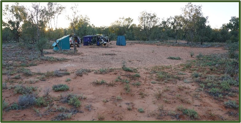
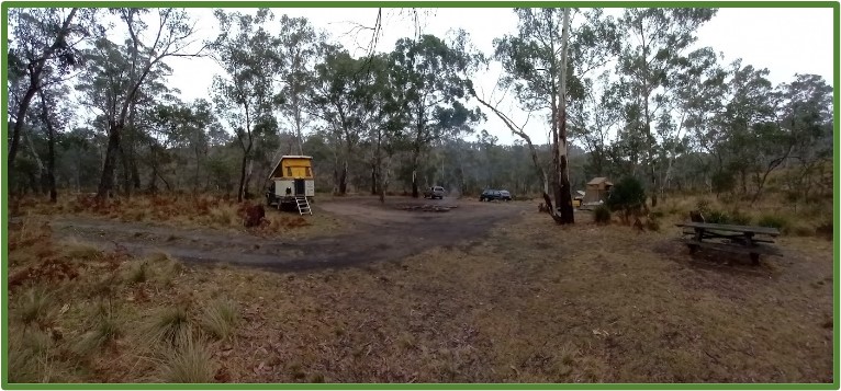
We left the main road of Lithgow and turned right onto the Great Western Highway towards Marrangaroo! The campground location was known in general as to location, but the route to get there was not known other than there being a maze of unnamed roads on the map. Sally and Jane’s phone had good reception and also was able to locate their position, so the lead role to show us the way was delegated to them for the dusty yet pleasant rip to the camp ground along some forestry roads through an old cattle loader and some farm gates.
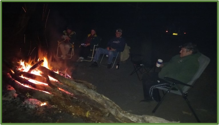
We arrived at the camp at 2:55 pm. Set up tents etc. and collected firewood as we anticipated it to be a cold night……… and it was. The evening was spent getting to know each other. We all sat around the camp fire, some enjoying a port while Anne Parfitt provided blow by blow updates of the Matilda’s match by phone. It was a real nail biter!
Meanwhile, we watched the bush tele having fresh strawberries and Cointreau with custard — and washed it down with select ports! It was early to bed around 10 pm once the soccer was finished!
We awoke to a light rainy start to the day which slowed packing away of the (my) equipment after breakfast.
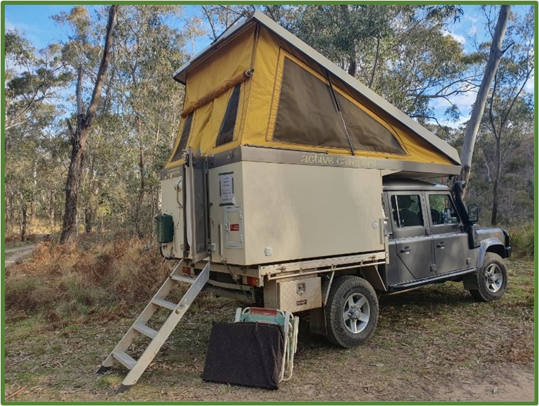
I learnt that the doors to the roof top tent need eyelets to allow the door to be help up on poles so the rain does not run off into the annex! Something to organise for next time! But all in all, I cannot fault the design of the Kings Roof Top Tent – save for the short ladder given my 3” lift and 35” tyres (making a 4.75 inch /120 mm lift over a Standard patrol). In my case I just carry two treated pine sleepers 600 mm long as a landing pad – much cheaper than a ladder extension – and can be used as a jacking pad. It took me two hours to repack the car the roof top tent as I was wiping things down as we went – everyone was very patient thank you!
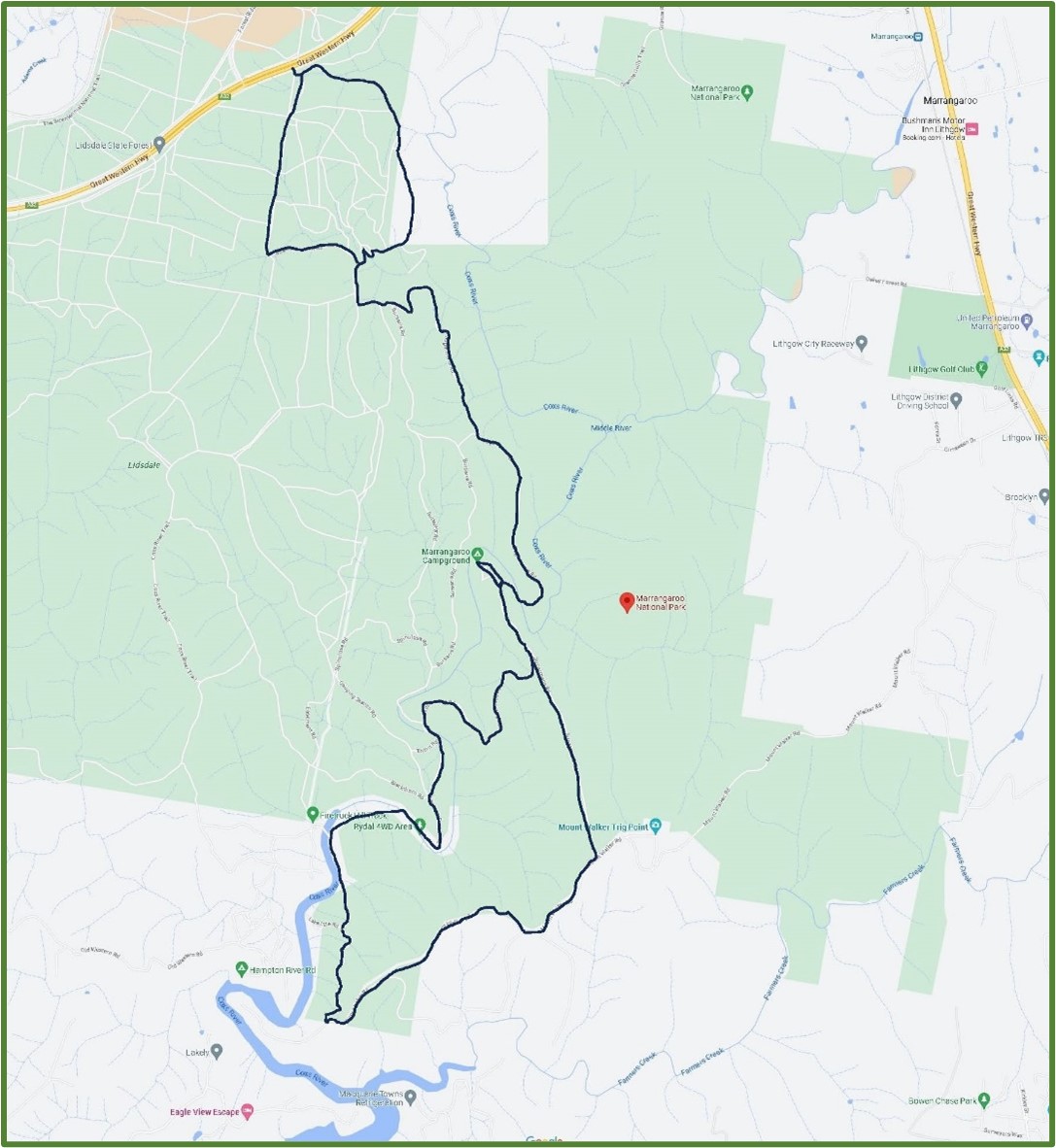
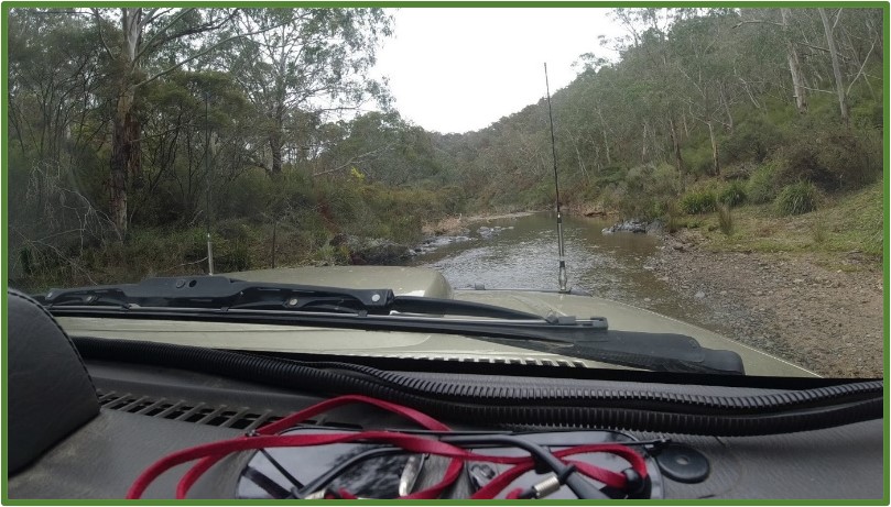
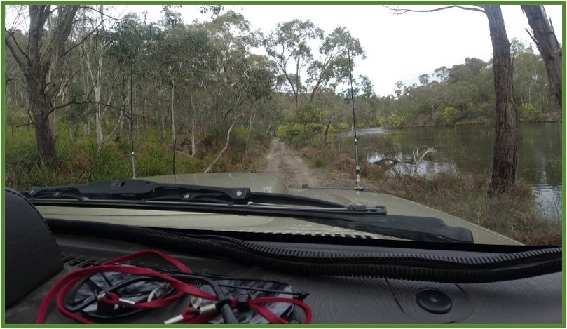
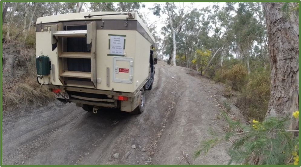
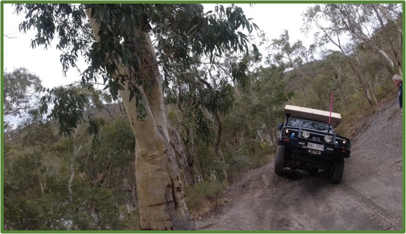
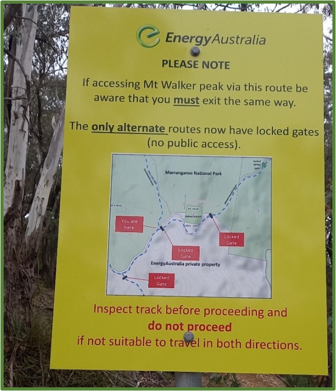
We got onto the trails around 11:30 am after a leisurely sleep in! The map above shows our overall route with day 1 being the hard left turn off the highway about 20km west of Lithgow and then hug the east side of the forestry tracks passing some old farm ruins here and there until we reached Sugarman’s Road then along it to the Campsite shown. Day 2 was to be hopefully much more interesting/challenging. We headed off to the Rydal 4WD Area (also shown on the map) which requires a short creek crossing of the Cox’s river, and later then a 600 m traverse along the river bed with about 200 mm in the river before heading up the slopes to the ridges.
The road along the river was very pretty and with the river starting to widen out we ended up coming to a long meandering hill climb that would take us up to the ridge. Left was extreme, right went 50m, and middle was the only forward route, unless we went back.
So, we did the hill climb.
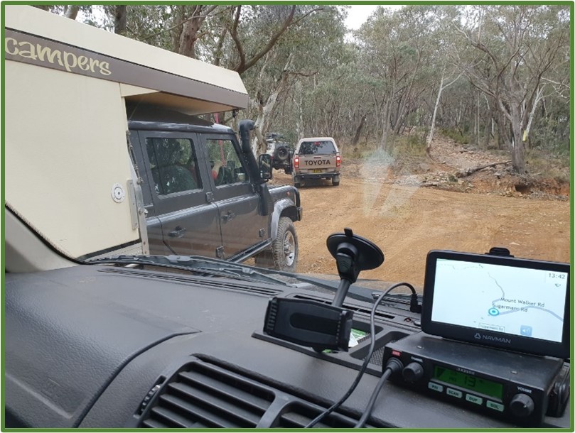
Our aim was to head along Mount Walker Road back to Lithgow! Well, that was short lived.
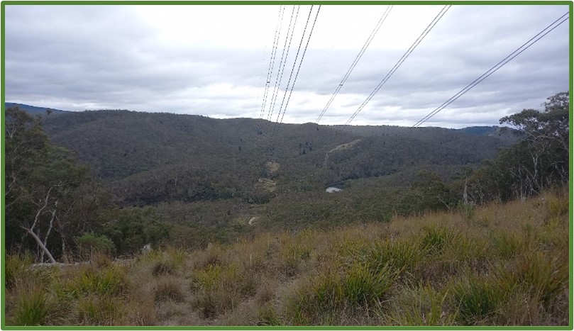
We then travelled along the range via Sugarman’s Road and passed some great viewpoints.
Before long we were back at the campsite! So, we had a late afternoon tea at 3 pm, and then said a prayer for being provided such great company and safety of the trip and headed off with Sally and Jane in the lead (their phone gave a better positional mark on the maze of tracks so we could find our way out with the minimum of fuss).
We turned onto the blacktop and said our farewells…..
Then our Lord had other ideas! Peters clutch failed just as he decided to pull out onto the highway….
So, we spent 2 hours trying the get his truck moving and then flat towed him 19 km back to Lithgow… until the men in blue pulled them over as it is illegal to flat tow in NSW. We all assisted Peter and made sure he had a place to stay and could get his car to Toyota in Lithgow for repairs. {Follow up with Peter the whole clutch disintegrated then and there damaging the fly wheel – $5000 repair and 8 weeks for parts to come from Japan}.
Luckily he was not deep into the bush or down a steep hill.
Trip Summary: • A relaxing easy trip. • Difficulty C grade in sections C+/B- on the hill climb. • Two day timeframe was adequate.
A major failure like Peter’s is rare! He said he will keep 4WDng.
Danny Lee – First time TL!
Posted inTrip Reports|Comments Off on Marrangaroo Campground and Rydal 4WD area
One man’s view about the things that really matter….
Love and pray for your enemies
Matthew 5:44 says, “But I say to you, Love your enemies and pray for those who persecute you.”
It is extremely easy to pray for those in our families, our friends, and for ourselves. However, it is a whole new ballgame when we realize that Jesus called us not only to pray for those who we like but also for our enemies. He even goes as far as to say to love our enemies and pray for those who persecute us. This means the bullies, the evil leaders, the harsh co-workers, the rough family members, and the most terrible of people can be prayed for in the power of Jesus.
Who do you feel is your enemy today?
Who in your life is overwhelmingly discouraging or wrong to you?
Jesus is not saying that we should be victimised and abused, so please set healthy boundaries in place. He is, however, saying that we are called to pray for those who are difficult and hurtful. We cannot do this on our own, but with the help of the Holy Spirit, we can have true strength to pray over those who seem the furthest away from Christ. We can remember the apostle Paul as we pray. He started out as Saul, a persecutor of Christians, and killed them. Then, Jesus pursued him, and he came to faith in Christ, changing his name to Paul. We never know if a person was praying for Saul to know Jesus. A man who appeared to be a great enemy of the church then became one of the greatest evangelists of all time. We must remember that Jesus is capable of changing any heart.
Ron Paton TRAX Chaplain
Posted inCROSS TRAX!|Comments Off on Love and pray for your enemies
Details:
Saturday, 12th August & Sunday, 13th August 2023
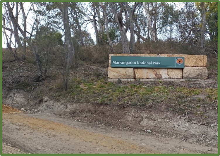
TRAX trip – Marrangaroo NP Camping Trip
G’day,
As a start this is what I have decided to do… go camping! Its only about 2.5 hours away so should not be taxing…
As the Trip convener I have not idea how to drive our system but I am going to lead a “suck it and see” trip to Manangaroo Campsite on Sat 12th to 13th (one night) with a view to relaxing and just exploring the area. There are only 8 places at the campsite and at the time of my booking (31/7) there were 6 left! Fee is $6.00 as a booking fee. BYO everything to this campsite. You will also need a National Park Access Pass. Details of departure etc to follow. It in not meant to be a drive all weekend trip!
Trip Leader – Daniel Lee
Mobile 0431 201 421
Email – trips@trax.org.au
The usual stipulations: Camping gear, food, recovery gear, UHF CB channel 13 and camera ( pictures for Editor)
One man’s view about the things that really matter….
But about that day and hour no one knows
“But about that day and hour no one knows,” Jesus says. The day and hour about which we do not know comes to us in a thousand different ways. It comes to us as an unexpected gift, an unwanted loss, an unimagined future, a dream come true. Regardless, we had no way of knowing when, how, or if it would come. And we had no way of knowing what it would bring. Despite our best efforts to plan and prepare for the future, we live in the midst of uncertainty and unknowing. There are days and hours that take us completely by surprise, in good ways and in not so good ways. The day and hour of uncertainty and not knowing are what Advent is about. Advent isn’t just a season in the church year. It describes our life. The seasons of the Church year are a lens through which we see and reflect on our lives. Advent, whether in the Church or in life, always begins with the day and hour about which we do not know. Nobody knows when, where, or how that day and hour will come. It is unforeseeable and unpredictable. It comes, Jesus says, like a thief in the night or a sweeping away flood. Every year the gospel for the First Sunday in Advent sounds ominous and threatening. We call scripture like today’s “apocalyptic” – hearing them as end of the world texts. Apocalyptic days and hours are difficult ones. That’s often how it feels when life is uncertain, the future is unpredictable, and we are powerless to control what comes next. It can feel like the world is ending. Life can feel chaotic and out of control. We often don’t know what to say and sometimes we don’t know what to pray. Questions abound and answers are few and far between. Explanations neither satisfy nor make sense. That day and hour is not so much about what is happening in our head but what is happening in our heart, that deep place where the mystery of God and our own life meet. The question then is not about the end of the world, but about how we live with uncertainty, not knowing, and powerlessness. What does faithfulness look like in those times? How do we live in the midst of impermanence? Where is our centre on that day and hour? The challenge of Advent, of that day and hour about which you do not know, is to cultivate what the poet John Keats called “negative capability.” Negative capability is the ability to sustain uncertainty, to live with not knowing, to stand in the mystery, to keep the questions and possibilities open, to embrace ambiguity, to not be too quick to resolve or shut down doubt – and to do all this without running away and trying to escape, without grasping for facts and reason, without blaming others and justifying ourselves. I think that’s what Jesus is getting at when he says we are to “keep awake” and to “be ready.” Keep awake and be ready for what? I wish I could tell you, but I can’t. I don’t know. It’s the day and hour about which no one knows. The most I can tell you is to keep awake and be ready for whatever comes to you, and what does not come to you. It is the unfolding of your life. Yes, days and hours are unpredictable, unknown, and impermanent. However, that doesn’t diminish life rather it intensifies life. It heightens its value. It deepens its meaning. It opens us to the possibility of the impossible, to life and more life. Everything matters. And we don’t want to miss a moment.
(With thanks: Rev Neale Somersby) Ron Paton TRAX Chaplain
Posted inCROSS TRAX!|Comments Off on But about that day and hour no one knows
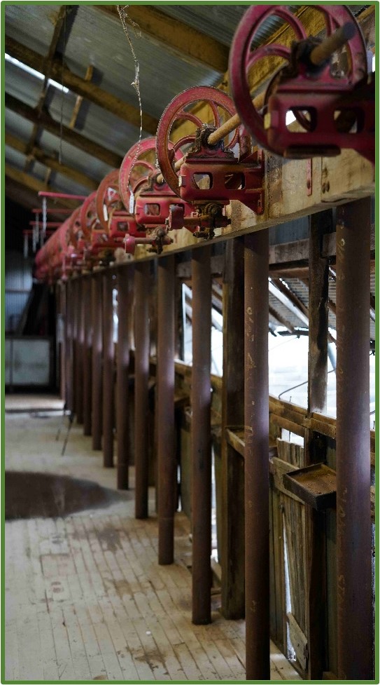
After a lengthy wait to see if we could traverse the Madigan Line, as many tracks and roads were closed due to the unseasonal rains in Central and northern Australia, we were on our way west, though we had to keep an eye on access east of Camp 16. Phillip had left home on the Saturday, taking a more relaxing time getting to our meeting place in Renmark. Rob and Alec left home on the Monday and had an overnight stay at Mamanga Campground in Yanga National Park near Balranald, on the banks of the Murrumbidgee River. It rained consistently overnight and we awoke with pools of water in the tent. We dried it out as best we could, then spent a few hours exploring the Yanga Woolshed and associated buildings, built in the 1880’s, before heading off to meet Phillip in Renmark on the Tuesday afternoon.
The next morning, we went shopping for fresh fruit and veggies as we weren’t able to bring them through the quarantine restrictions around the Riverina and Riverlands areas. Our destination for the night was Peterborough, so we got on our way and passed many orchards of oranges, almonds and other produce along the way. Needing fuel, we checked the South Australian ‘ShouldIFuel’ app and found the cheapest enroute to be at Terowie. We stopped there and found that the owner of the service station is the owner of the ‘R&R Beadbreaker & Tyre Refitting Tool’.
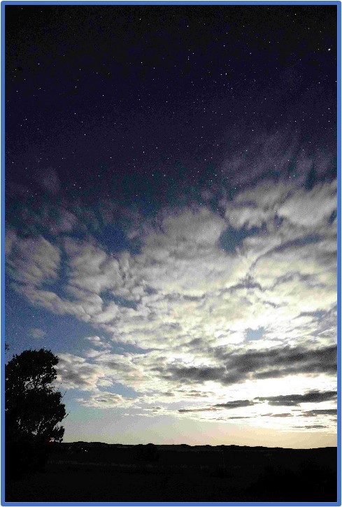
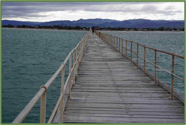
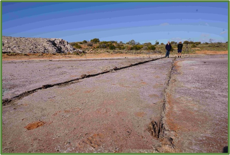
We arrived at Peterborough and set up camp within the local caravan and camping ground. After a yummy dinner, and doing some experimental photography of the starry night, we went to bed. We woke up next morning to find a bit of water in our camp, or more correctly our own lake, after heavy overnight rains, so we spent a few hours drying out yet again. Wanting to evade any more inundations, we looked up the BOM app and found that the southern areas of SA were due rain over the coming days. “Let’s head north” was the cry, so we changed plans and made tracks towards Woomera. We were going to check out Bendelby Ranges 4WD and Farm Stay, but that will have to wait until next time. Along the way we visited Port Germein, reputedly the longest wooden jetty in the southern hemisphere built in the 1880’s. We walked the 1676metres to the end (and back!) in the blustery winds before driving to Port Augusta then then north towards Woomera.
Port Germein
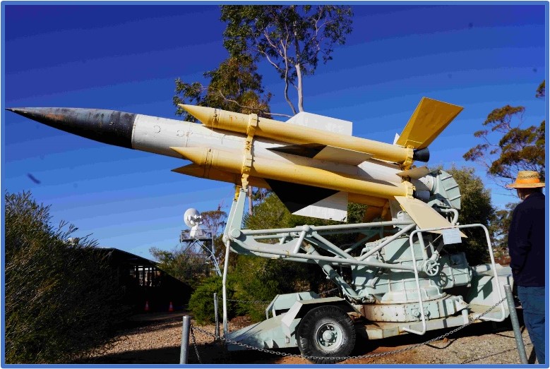
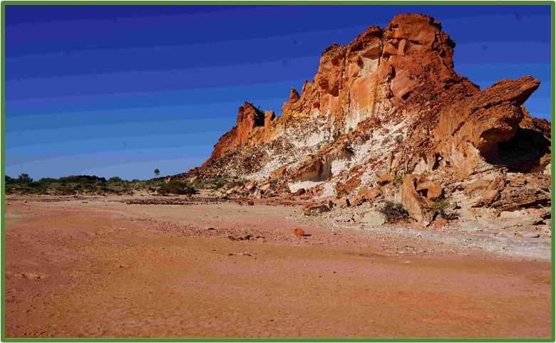
We arrived early evening and set up camp at the Wommera Campground. The internet promised grassed tent sites, but we found red sand instead! We decided to spend a day exploring the township of Woomera, and even though the museum was closed for renovations, we still had a very interesting time looking at the open air displays and also the displays within the visitor’s centre. Next morning, we checked the BOM and the various road condition websites again, and it looked as though completing the Madigan was not possible. The best option for us was to continue onwards and the check at Mt Dare before making a final decision. We already had a Plan B and Plan C in case we weren’t able to get through to Birdsville. Plan B was to start at Mt Dare and go as far as the Colson Track on the Madigan, head south, then back to Mt Dare along the French Line. Plan C was to traverse the Madigan then turn north and have a trip up the Hay River track and come out at Jervois Station on the Plenty Highway. Our current plan, Plan D, was to use up a couple of days, heading towards Alice Springs and once there replenish our food and fuel supplies, then on to Mt Dare using the Binns Track. So, on the road again, we headed towards Coober Pedy. Not far up the highway, we came across Lake Hart, the largest salt lake in SA.
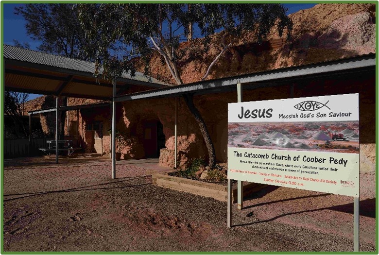
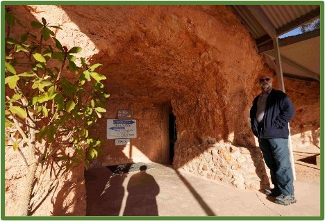
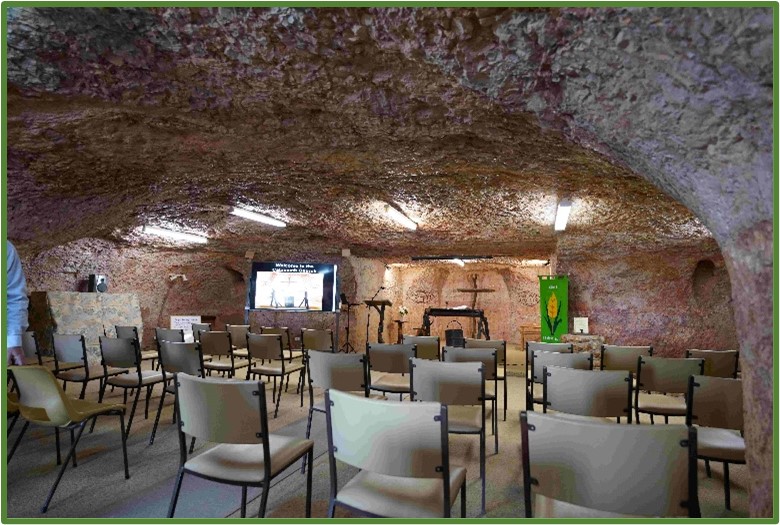
Normally there is no water in the lake, but there was at the time. We spent some time exploring the shores of the lake and found remnants of the salt mine that ran from 1918 until the 1930’s. Now at Coober Pedy, again, we were promised grassed tent sites by the internet and again we were misled! Tomorrow would be Sunday so we decided we would attend the Catacomb Church. Like so many ‘buildings’ in Coober Pedy, this church is underground. When we got there, it appeared as though we might be the only ones attending, but as the 9:30 scheduled time became closer, the little church was nearly full. Like us, many of the congregation were travellers. After the service we went to the town lookout then hit the road for Erldunda.
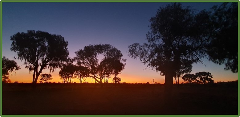
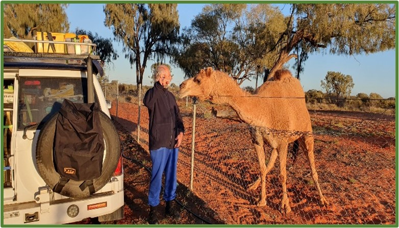
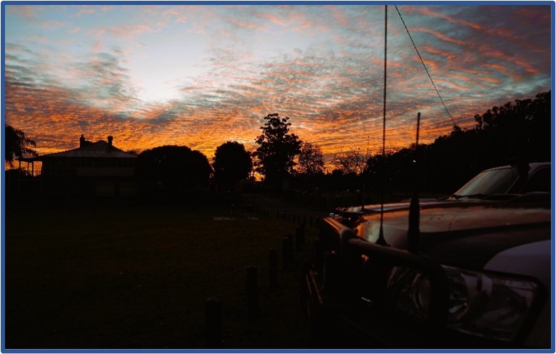
At Erldunda, the sunset was ‘typical outback’ with the colours changing through pinks, oranges and purples. The next morning was chilly as usual, and we awoke to a variety of animals next to the campsite, one of which being a camel.
Phillip quickly became friends with the camel until the camel decided it wanted to reach over the fence and try to eat the wheel bag and the open door frame and the driver’s side mirror. Not content with being shooed away, the camel then tried to eat the driver’s door on Phillip’s Patrol, leaving tooth marks in the paintwork! A quick exit from the camp site and on our way to the Henbury Meteorite Craters. Once off Stuart Highway, we encountered the effects of recent rain events, with the road into the Craters, flooded in spots. The craters are a short walk away from the carpark and worth the visit. The craters are clearly defined and have a multitude of flora within them, as well as a surprise with one having a permanent water source providing an oasis in the desert.
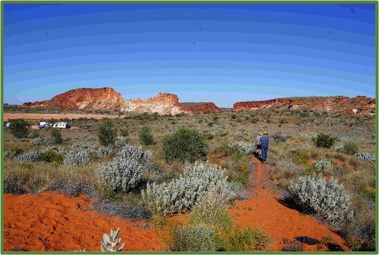
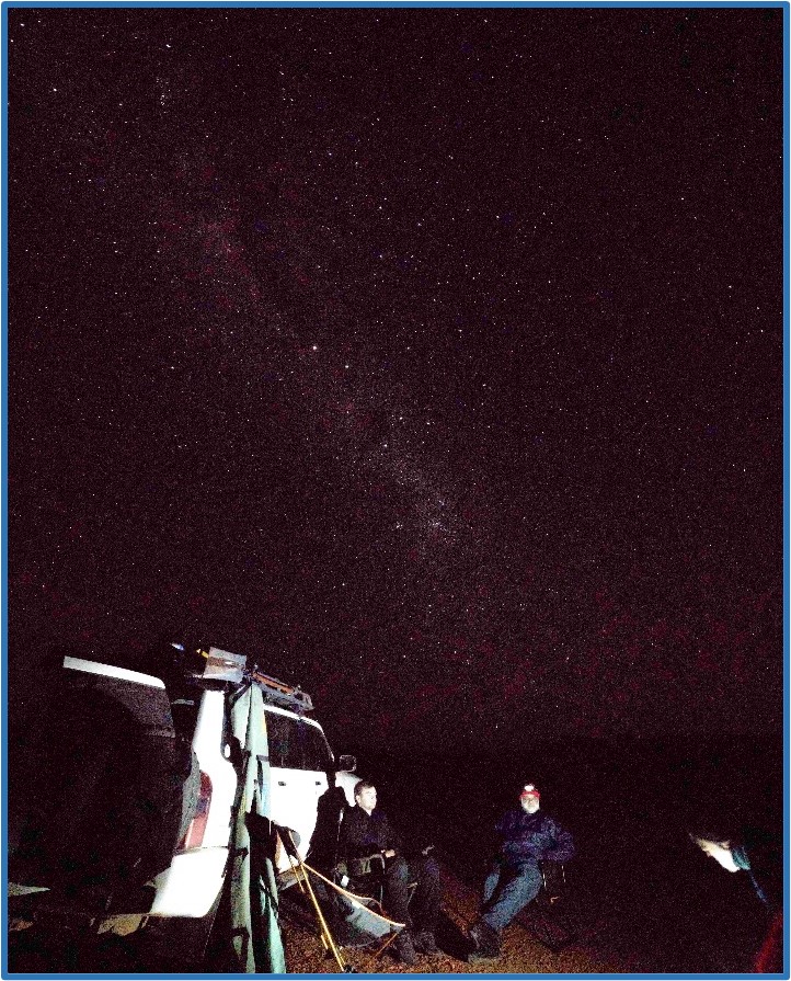
Our overnight goal was Rainbow Valley Conservation Reserve which is only 20kms off the highway. The track in was nearly completely corrugated which made for slow and uncomfortable going, however the view of the afternoon sun on the rock face jutting out of the desert was worth the effort. We set up camp and then set off for a walk around the ‘valley’, completing each of the walks on offer. Rob cooked a green chicken curry for everyone which was heartily enjoyed. We topped that off with apple pie and ice-cream (yes, ice-cream – from the freezer!) After cleaning up we set about doing some more experimental night photography.
After snapping a few successful photos, we were off to bed. Next morning was decidedly frosty and we even had ice on the inside of our tent. Today would be spent at Alice restocking fuel and food before heading to Mt Dare. We were also keen to get some internet access so we could check if the conditions ahead had turned more favourable. (to be continued) Rob Drummond
Posted inTrip Reports|Comments Off on The Madigan Line Part 1
Trip Report – Commission Road Recce (off Putty Road) north Of Sydney Thursday 22nd June 2023
Neil Flower & Mac Cusiter – Discovery Alex Levshin & Geoffrey Written – Ranger John Woodard & David – Prado Ralph Radovan – Range Rover Rob Drummond- Patrol Phillip & Linda Favaloro – Patrol
Unfortunately, 2 members who had booked in to come had to drop out, one due to catching Covid. – (hope that you are feeling OK now Richard.)
Day: Winter solstice, therefore fewest hours of daylight for year.
Conditions: Cool, but not too bad. Weather: Fine till late in afternoon, then light drizzly rain.
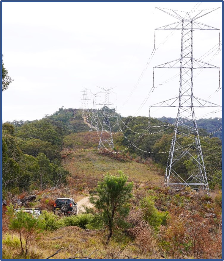
We met at Macquarie Park, Windsor, at 7:00am. Left at 7:27 am. Headed North up Putty Rd to near Howes Valley, turning off into Commission Rd. – so called because it was originally put through by the Electricity Commission as it was then known to follow the High Voltage power lines from the Hunter Valley power stations.
Some rain had been forecast but the day was reasonably warm and quite sunny with only a little cloud on the Northwestern horizon. This would change to a light drizzle very late in the afternoon when we were on our way home.
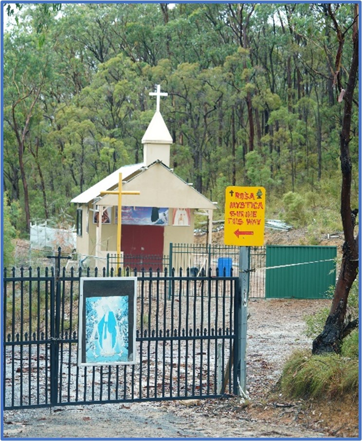
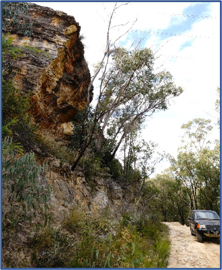
Our first stop was the Grey Gums café (closed – we were still too early for them) at 80 kms, where we had an early Morning Tea for 15 mins then off again towards Howes Valley where we turned left onto Commission Road. (104kms.) This is a is quite good road, only a very few slightly rough patches, indeed a 2 wheel drive vehicle could manage it without too much difficulty. Some interesting scenery and interesting places to photograph along this stretch including a quaint little Lebanese Catholic chapel situated by itself right in the middle of the bush.
Although winter there was a surprising number of wildflowers that were still in bloom – some stands of Flannel flowers and other native blooms not forgetting a great number of the winter blooming species of wattle which were everywhere.
At the 130 kms is the spot known as ‘Kings Cross’ where the Old hunter Main Trail heads west to the old crossing of the Gt. Dividing Range (closed now thanks to former Premier Bob Carr and his absurd ideas of locking up the bush), and also Sheepskin Hut. We continued North along Commission Rd., the aim being to come out at the village of Bulga on the Putty Road.
Alas, no such good fortune! The NPWS had put a Boom gate across this track also with a sign saying that it was closed temporarily due to track erosion or some other such excuse.
Temporarily? If so, then why such a massive and solid boom gate/barrier?
Never mind, perhaps one day our grandchildren may be able to do this road.
Backtracking half a kilo to Commission Road again we turned North again and headed towards Jerry’s Plains.
It was while we were doing this stretch of the trip that Ralph Radovan received a phone call telling him that his mother, who had been ill for some time, had passed away. TRAX believes in being a caring organisation and so we stopped and gathered around Ralph to pray with him and offer our heartfelt sympathy at this time of great shock and sadness to him. TRAX members are asked to keep Ralph in their prayers over the coming weeks.
Jerry’s Plains is a village on the ‘Golden Highway’ which runs from near Singleton toward Denman. No good place for lunch there so we headed East toward Singleton to the next village of Warkwarth where there is a nice park with tables, fireplaces and toilets.
Lunch! It was good. One of our visitors decided to try out his Drone there (I think it came back) while the rest of us enjoyed a very late lunch. By the time we concluded that the daylight was fast running out so we decide to head for home. Some went on to come via the M1 while others came back along the Putty Rd. to Windsor.
Conclusion? A good day. This will make a nice day trip when Spring comes. By then the bush should be a mass of wildflowers to complement the great mountain views that are to be glimpsed along the way. Don’t miss this trip when it is announced. The things that we didn’t get to see because of the lack of daylight will be included when the days get longer.
Neil Flower Recce Leader
Posted inTrip Reports|Comments Off on Commission Road Recce