Trip Report – The Madigan Line Part 2
Monday July 3 – Thursday July 27
Rob & Alec Drummond – Nissan Patrol
Phillip Favaloro – Nissan Patrol
Continued…
We reached Alice just in time for elevenses and worked out our plan of attack. The interwebby thing showed access to Birdsville was still blocked but getting to Mt Dare was open with caution via Binns Track or Finke. This left us with a decision to still ‘do the Madigan’ but we needed access to Birdsville to do that, so that wasn’t possible at that time, but would it be possible within 6 days should we set off? The other option would be to get to Mt Dare and then wait for the way through to Birdsville to be open. We were still hopeful we might be able to follow Plan A, do the Madigan, but we would need to check the interwebby thing via our family via satphone as we travelled south to Mt Dare. The decision made was to do the Binns Track, get to Mt Dare and then determine which way we could travel.
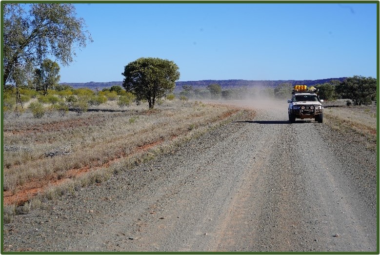
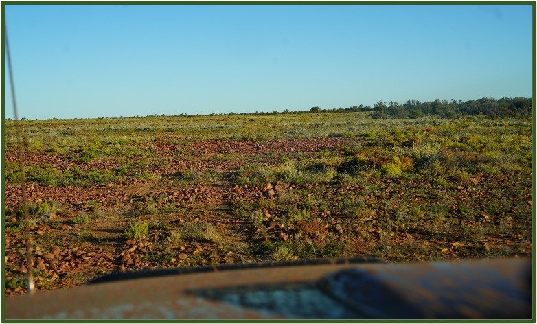
After stocking up on food, water and fuel, we headed south along the Old Andado Track, which forms part of the much longer Binns Track. The track is wide and well maintained as it’s the only route between Alice and the Santa Teresa township. We continued along with the scenery becoming more interesting the further south we travelled, as we passed between parallel mountain ranges with exposed rock faces. We had to slow down as the track takes you through Allambi Station and even takes a 90 degree bend at the homestead.
The sun was getting lower so we started looking for a campsite for the night eventually settling on an open space about a kilometre along a not often used track, to the south of the Old Andado Track. We could have stopped earlier than we did, but there was a lot of tall grass coverage after the recent rains. We soon had our camp set up and a fire ready to keep us warm in the cold desert night.
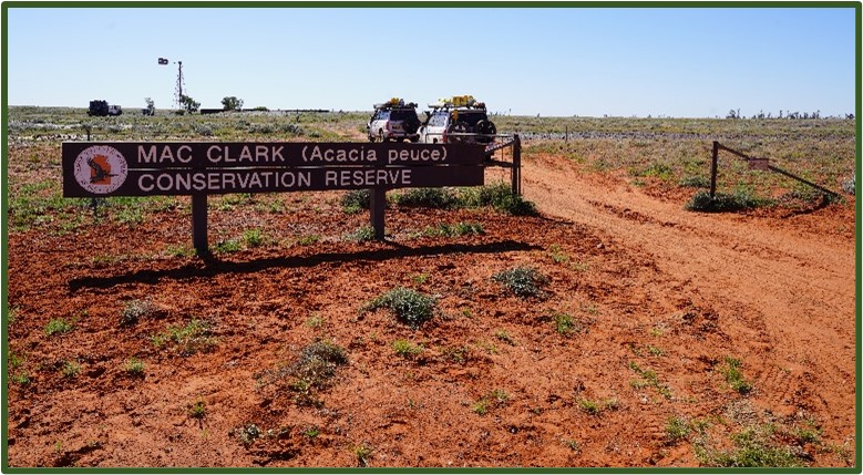
Next morning, we packed up and set off towards the Mac Clark Conservation Reserve to see the stand of fabled Acacia peuce. We found the track in good condition and we were able to maintain a reasonable pace – not that we were in any hurry! The track south followed between the parallel mountains (hills really) and dunes, stopping at regular intervals to take photos of the countryside. By mid afternoon we reached the Reserve, navigated the various fences and gates to find the visitor area, then spent a while investigating these very rare trees.
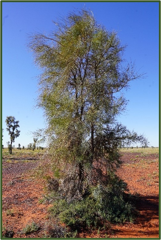
Acacia peuce is commonly known as the Waddy Wood and is a tree that grows to 18 m tall. It has a growth habit similar to a Casuarina. Young trees look like conifers in shape. The dull green phyllodes (pine-needles) are long and thin with a sharp tip, growing 8 cm to 40 cm long and about 1 mm wide. Pale-yellow flowers are produced in autumn and spring usually after heavy rain. The flower heads are globular. The seed pods are oblong and flat with a papery texture, growing to about 20 cm long and 3 cm to 5 cm wide. They are very slow growing and are only found in small pockets within arid zones of Australia.
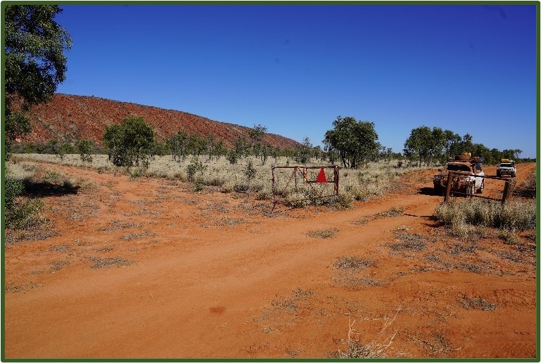
We had already decided to spend a night on the Madigan, just so we could say we had at least been there, so set off retracing our steps to find our way onto the Madigan. So why mention this? Well, in the last few days we had seen a YouTube video of someone trying to find their way from the Reserve onto the Madigan. They couldn’t find any obvious track forward so they apparently followed someone else’s tracks over, yes over (or through) the fence line surrounding the Reserve. Granted, there aren’t any obvious signposts, but I’ve never known the way forward over a wire fence! The way onwards was easy enough to spot even though it was a hand painted sign to the right of the Reserve entrance gate. Following the sign, we navigated wash outs and small lakes to the main track.
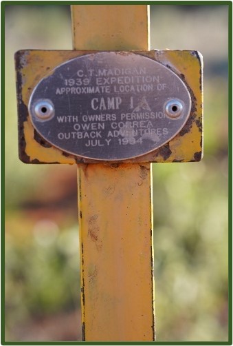
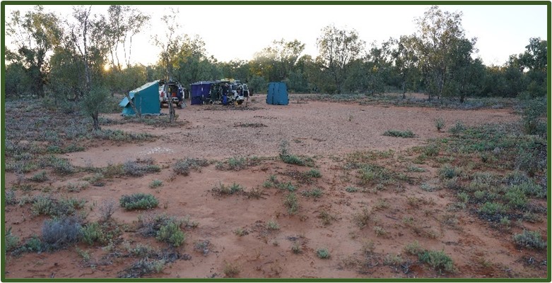
Enroute to our destination of Camp 1A, we found that recent rains had re-aligned the track resulting in the inevitable maze of new tracks as people try to find their way forward. This was particularly true around East Bore, where we spent about 45 minutes ‘exploring’ the area around the track. We found our way onwards enduring the corrugations for the remainder of the trip until we reached Camp 1A.
Tonight’s dinner was going to be a bit special, so Alec spent some time ferreting around for firewood then preparing a fire suitable for cooking a lamb roast! Rob spent some time walking around cleaning up after the grubs that ‘love the great outdoors’!
After a hearty dinner, we sat around the bush TV and solved the World’s problems…
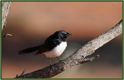
Next morning was crisp and clear and we enjoyed our breakfast with a friendly willee wagtail who tried to evade the cameras which came out to capture this wild bird that was comfortable being so close to the humans invading his territory.
Packing up was getting pretty easy at this stage as we were well practiced by now, but the quicker we packed up, the quicker we’d be facing the 30 or so kilometres of corrugations back to the Reserve. Before starting the corrugations, we emptied the diesel jerrys into our tanks reducing the weight on our rooves.
We got through the maze around East Bore until we followed a definite set of tracks which quickly ran out, leaving us well away from where we should be. We turned around and backtracked until we saw the remnants of the bore thereby finding the route towards Mt Dare. Passing by the acacia peuce reserve, we quickly found our way on the track towards Old Andado Homestead.
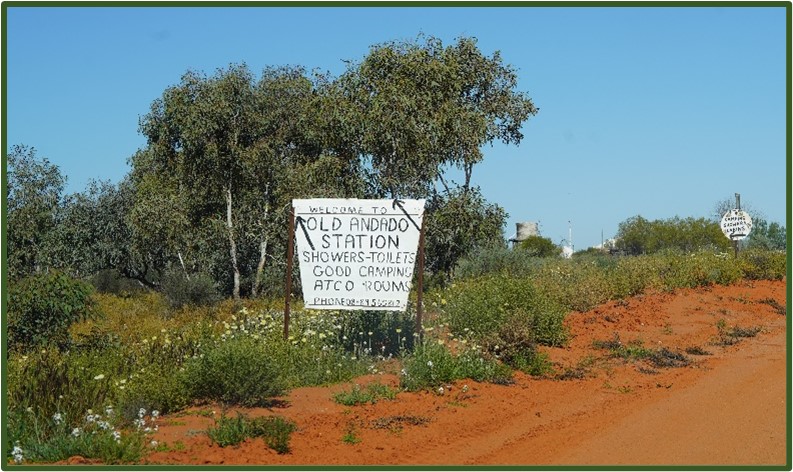
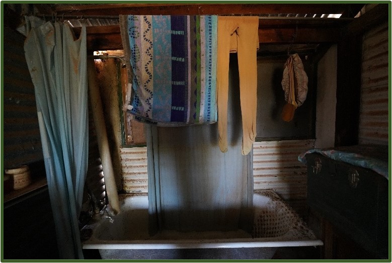
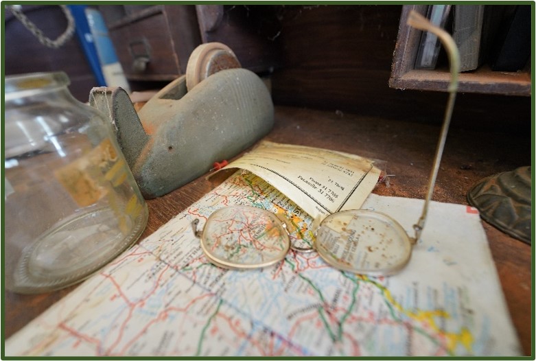
Reaching there around lunchtime, we had a quick snack and explored the buildings and grounds of the abandoned homestead. It is indeed truly remarkable to see how the Clarks lived for so many years in what must be some of the harshest conditions Australia has to offer. The buildings are all open and you’re free, for a gold coin donation, to roam at will. Yes, as you’ve seen on YouTube and read about, everything is still in its final resting place, be that in the bedrooms, the kitchen, the utility rooms etc, with only dust and a few birds interfering with the ‘lived-in’ appearance.
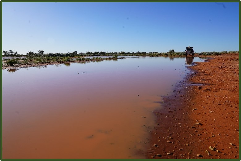
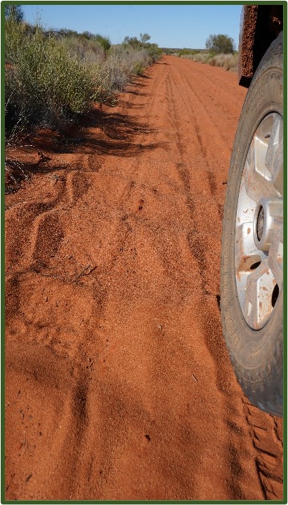
We now had about 100kms to get to Mt Dare. The track again, was in good order and we were sitting on 80pkh or so, only slowing down for closed gates or water across the main track. We passed through what we thought should be the NT/SA border with the surrounding countryside showing clear signs of recent water activity. Not long after entering SA, we came across a muddy section of track which appeared to go on for a very long distance – we couldn’t see the end! Rob had the job of scouting the track and wasn’t able to walk without either slipping over in the slippery slush, or sinking over boot height into the slush.
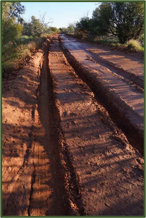
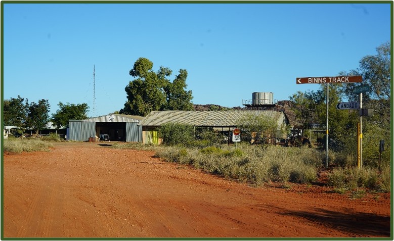
This was frustrating as we were only about 4kms from Mt Dare! It looked as though a large vehicle had been through and left very deep ruts. In parts, the track either side of the ruts was reasonably solid, but the risk of slipping into the ruts and being hung up on the pumpkins was too great a risk. As time was getting on, and not wanting to start on a long after-dark recovery, we tried to get around the bog by venturing out onto the rocky plain to the south of the track. We made slow and bumpy progress, but we weren’t able to get any closer to Mt Dare.
After nearly an hour, we stopped and checked our position on our GPS devices and paper map before deciding that discretion is the better part of val0ur, and hopped on the phone to Mt Dare. We found them very helpful and learnt that someone had indeed driven north from Mt Dare and chewed up the track for about 3 kms! They said we could give it a go and if not successful, they would be happy to come and get us – read “rescue you for a fee if you get stuck”. Not being on a tight schedule, we decided to head back north and camp over the NT/SA border where a camp fire would be allowed. (the area north of Mt Dare to the border is National Park where all fires are banned).
We found a large flat space just after crossing the border and set camp had a hearty dinner and watched the bush TV until bed time.
(to be continued)
Rob Drummond