TRAX Recce Report – Lost City
6th January 2024
Eric & Diane Toyota Prado TL
Phillip & Linda Nissan Patrol TEC
In all my years of four wheel driving I had never been to the Lost City. I did get close once but we turned around due to a wet track. Eric and Dianne did a day trip to the Lost City about six months ago. We wanted to catch up and the Lithgow area is about a half way point between our homes. I suggested we go to the Lost City as they knew where it was!. The first meeting place suggestion was Bungleboori, as they would come in from State Mine Gully Road and we would come in from the Zig Zag Railway. In the end we decided to meet at the Zig Zag Railway at about 9:30. We arrived at the Zig Zag Railway a little early to find the car park closed and a lot of “no parking” signs. There were a few other vehicles around and one person asked about toilets. She went over and reported that the gate was closed. Dianne kept us updated on their progress and when they arrived we hurried off to find a secluded spot and converse with mother nature.We stopped at Bungleboori for morning tea and were entertained by a couple of clowns playing in a deep bog hole across the road. He had a beautiful spray of water coming from the wheels. I would say it was at least two meters long. Eric spoke to some campers and helped him with his CB.
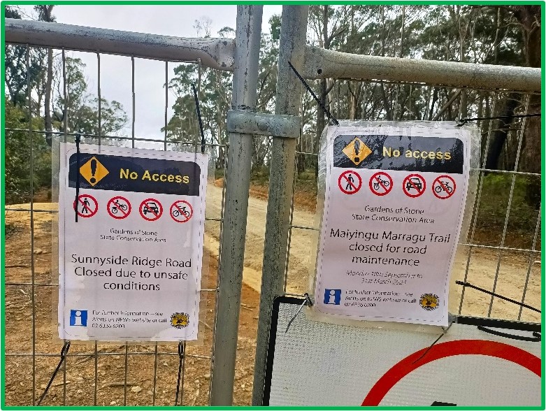
Maiyingu Marragu Trail (Blackfellow Hand Road) was closed for maintenance and should reopen on the 31st March 2024. Sunnyside Ridge Road was closed due to unsafe conditions. Well, we are not going that way. Luckily for us the track down to the Lost City was just next to the fencing used to close the road. On our way in, Eric stopped to get information from some of the vehicles leaving the track. There was a mixture of an easy track to a challenging track. We went in and veered to the right. The track was easy to start but soon degraded. We stopped and Eric and I walked the track picking our lines. At the top was a track to the left. The track forward looked even more difficult. I was glad Eric was in the Prado as he would have tackled it in the ute. We went back to our vehicles and drove the track using the lines we had picked. The track on the left was the right one to take as we found our way to the Lost City. On our way we passed the extreme track and found it is called Ranger Bob’s Trail.We parked our vehicles in the parking area, as the track was blocked and only available for walking. Dianne and Linda had a look decided not to tackle the rock steps that lead further on. Eric and I went down the track and explored the area. We saw a small dam off in the distance, another track on the other side of the valley and billy goats (kids) on the rocks. In another area across the valley were bulker bags that were used to stabilise the hill side. We went back and had lunch by the vehicles.
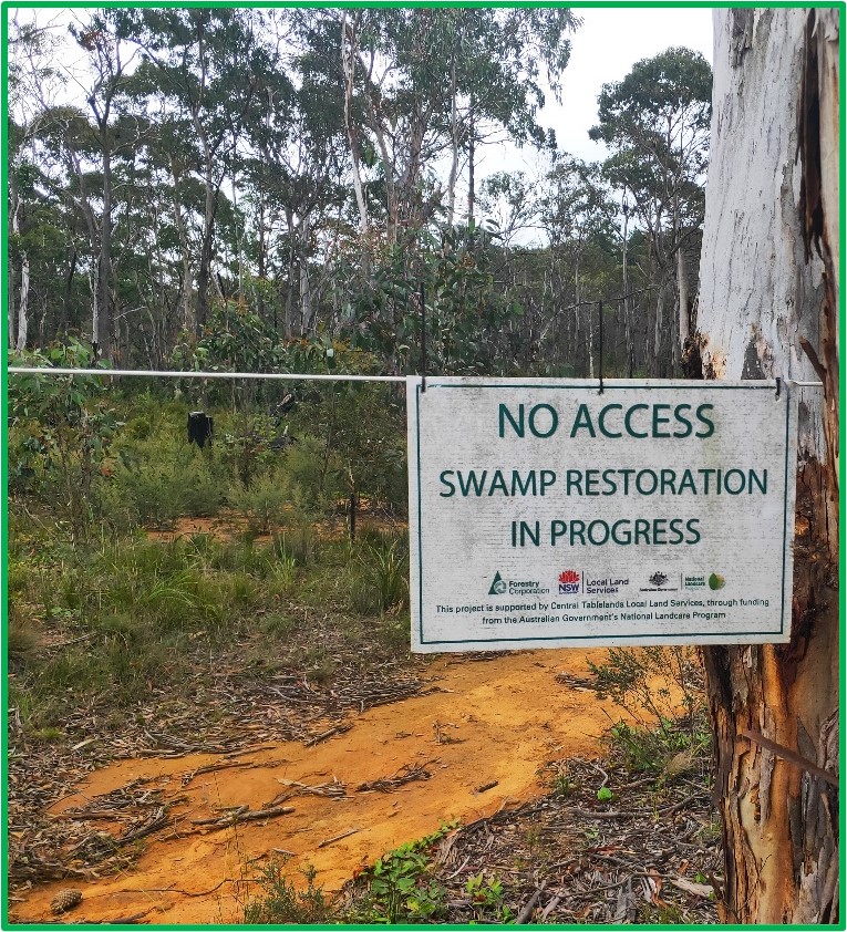
This gave us time to catch up and plan the afternoon. The plan was to go back to Bungleboori and take the track next to the camping area.Our journey back to Bungleboori was easy. Somehow we missed the difficult section and enjoyed just the dirt road experience. Back at Bungleboori we crossed the road and took the track next to the camp area. The track eventually lead us to Waratah Ridge Road. We turned and travelled along the track, we passed a fenced off area and Two Trees Road. Two Trees reminded me of past TRAX Christmas parties, as this is where we met. We followed Waratah Ridge Road to a three way junction and looked at our map. The GPS on my tablet was not getting any satellites. I had noticed on the last few trips it was taking longer to get a fix. I was now using my mobile phone and two tracks were dead ends and the other looped back. Waratah Ridge Trail looked like it went on for about 3km to a creek. The track to the right looked like it also went down to a creek. The track to the left doubled back and so you could do a loop. We decide to turn around and go back as it was getting late, it was about 3pm. We will explore another day. On the way back, being out on the track got the better of us and we decided to take a detour. We turned right and went to the end of the track and turned left to loop back. Along the way we noticed a sign in the bushes and stopped to look “NO ACCESS Swamp Restoration in progress”.
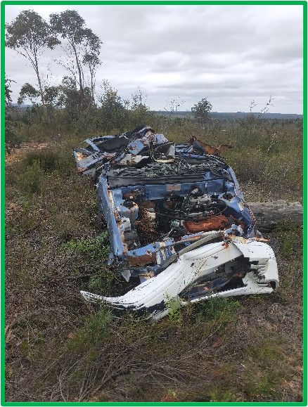
There were some wrecked vehicles and of course I stopped for pictures. There was a long wash away section where you needed to go past a tree with its root going out onto the track. This was just a bit narrow. We now needed to turn right to get back onto the Glow Worm Tunnel Road. The first track on the right was a short steep down and a long steep up with water at the bottom. There was another track further on and decided to take it. On reaching the track, we found it closed. The closed off area looked swampy. We ended up going further on and looping around at the end. The track took us back to the Glow Worm Tunnel Road with the last little bit at the end in low range just to make it easy. Back on the Glow Worm Tunnel Road, Eric had to stop so that I could get out of low range.We travelled to Bungleboori for afternoon tea and chatted until 5:30pm. Eric and Dianne took State Mine Gully Road home, while Linda and I went Old Bells Line of Road back to Zig Zag and home. On the way home we stopped for fish & chips. What a great day. Come and see The Lost City on the 10th Feb. 2024 with me. See you on the tracks.
Phillip
Notes:-
The Bungleboori Campground is located at the corner of Glow Worm Tunnel and Blackfellow Hand Road in the Newnes State Forest.
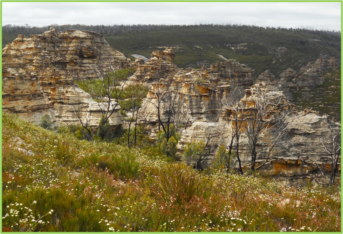
The Lost City is pagoda like formations of weathered sandstone in an amphitheatre of Blue Mountains bush and scrub. GPS Position -33.42 150.173.